
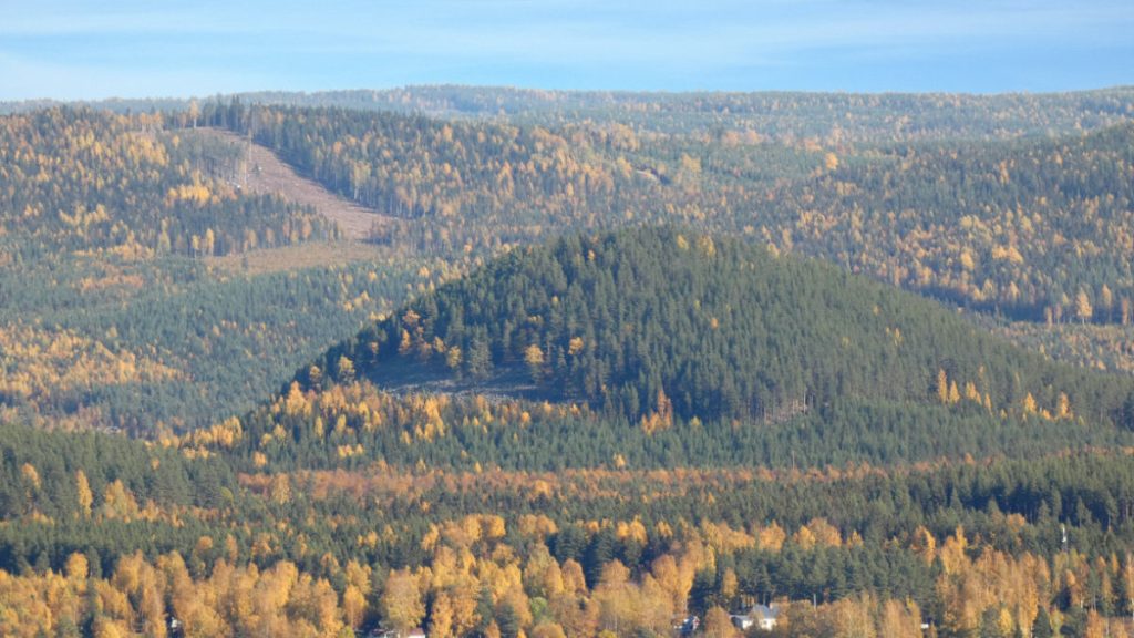
Hannmyrkullen
Undulating hilly relief with scree slopes
Some 240 million years ago the landmasses had moved around so that Sweden was located in the approximate area of southern France of the present. The climate was extremely hot and our country was a desert. These conditions led to the bedrock cracking. The cracks were scooped out and formed deep valleys. What remained of the old bedrock formed 200-300 metre high hills, one example is Hannmyrkullen.
Cracks in the bedrock were scooped out to become valleys
Some 200-100 million years ago, Sweden was part of the supercontinent Pangea. Our country was positioned in more southerly latitude and was covered by desert. Many dinosaurs were adapted for life in a dry climate and perhaps some of these frightening giants were roaming the Ragunda valley in those days.
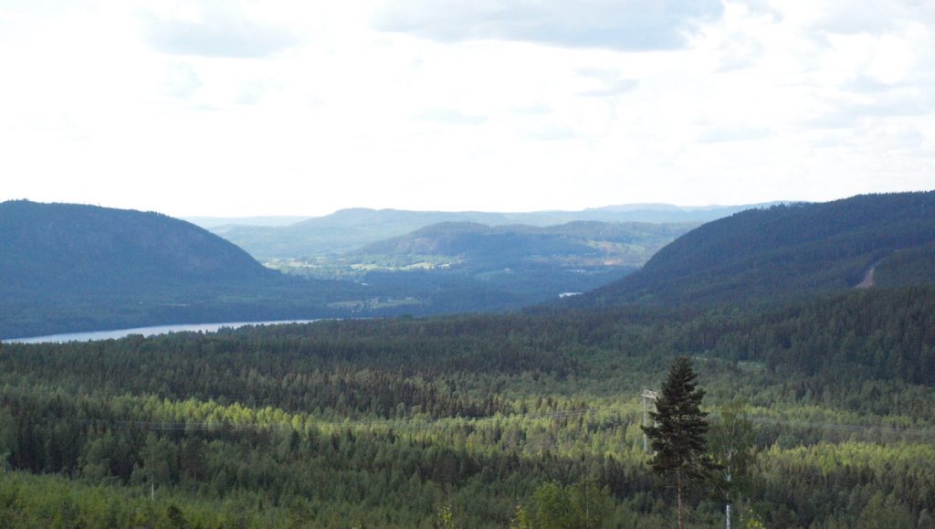
The dry and warm climate caused cracks to form in the flat rock, the peneplain. The weathering scooped out the cracks and formed valleys. The more hard-wearing sections of the bedrock were preserved as rounded or steep hills. Thus arose the undulating hilly landscape.

Peneplain – a flat stretch of rock
In these days the peneplain in the geopark consists of the high hilltops but in other places the peneplain may appear different. This is because the rock surface has been exposed to different activities.
In the crust of the earth there are areas or larger blocks of rock capable of moving upwards or downwards, straight or angled, towards or away from each other, because of movements in the innermost of the earth. A block pushed upwards will be exposed to faster and more aggressive erosion compared to a block that is pushed downwards and protected by loose deposits in the sea, for example.
The peneplain that can be seen in the province Västergötland, where the Platåbergen mountains ‘rest’ on the peneplain, was for a long period protected against erosion by a sea. The erosion-resilient rock diabase covered the tops of the hills and protected the more exposed species of rocks from erosion, leaving remnants called inselberg. In Ragunda there was no such protection, hence the weak zones were worn down and formed the hilly landscape.
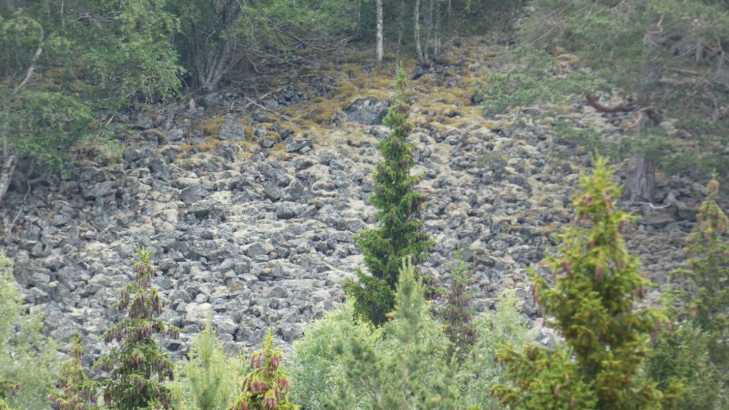
Rocky slopes with loose stones
High up on the hill Hannmyrkullen you can see a ridge of stones. They fell down the slope as the mountain weathered. These are called scree slopes.

Facts - weathering
Weathering is a process that mechanically and chemically breaks down rocks into minor particles such as stone, gravel and sand. The process is continuous and affects all rock surfaces.
The effect of the climate and the rock’s composition
The speed at which a rock weathers depends on the climate and also the composition of the rock.
Weathering goes slower in northern parts than in more southerly locations, where the climate is warm and humid. Weathering is also affected by wind.
Different minerals differ in their resilience against weathering. Also influencing is the texture, i. e. the rock microstructure, how the minerals are related, and the size of the grain. Since rocks are composed of minerals they withstand weathering to varying degrees.
Example of weathering
One example of weathering is when water in a crack in the rock freezes and breaks down the rock. This is called frost weathering.
Another example is when the warm sunshine of the day heats up the rock followed by cooling off during the night. Tension is built up that eventually causes breakdown of the rock. This type of weathering is most common in desert climates and may have affected the Ragunda area at the time when Sweden was located on more southerly latitudes in a hot climate 240 million years ago.

Weathering also occurs when lichen that grows on rock breaks this down by secreting acids.
Exposed faces of rock also weather as a result of direct descaling.
More information
Sites to visit on Theme Landscape
More site photos
Places to visit nearby


Practicalities
Accessibility
See Accessibility.
Activities
Take a hike on the hiking trail Pålgårdsleden. See also Activities in Ragunda.
Eating and drinking
During the summer Ragunda hembygdsgård is open. There they serve lunch and coffee. The nearest grocery store is in Hammarstrand. See also Eating and drinking in Ragunda.
Accommodation
Missing on site, but various options are available nearby. See Accommodation in Ragunda.
Getting here
SWEREF 99 TM N: 6 999 055 E: 571 160
WGS84 N: 63,113846° E: 16,410444°